
Wheeler Peak Trip Report
On Wednesday, October 28th of 2015, after fighting my way up steep slopes through deep snow, I fought to stand in 60+ MPH winds atop the 13,161′ summit of Wheeler Peak the highest mountain in New Mexico.
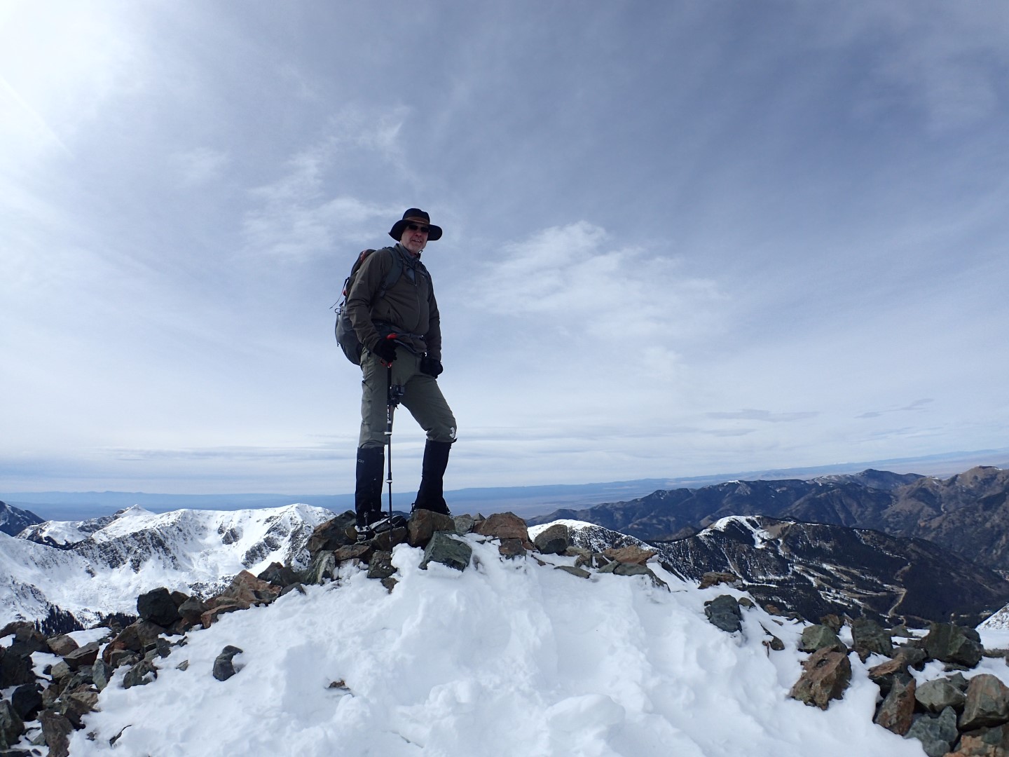
Danger standing on the summit of Wheeler Peak, NM
This highpoint trip was taken in “BigByrd” our 41′ motor coach and it was #40 out of the 50 states for me.
Highpoint Statistics:
Summit Date: Wednesday, October 28th of 2015
State: New Mexico
Elevation: 13,161′
US Rank by Height: 8th
Round Trip Hiking Distance: 8 Miles
Round Trip Hiking Time: 13 Hours
Highpoint Links:
Photo Gallery
Posts
Trip Report
GPS Track
Office Rangers
Before a climb of this magnitude, I like to call ahead and speak to the ranger station to see what conditions are and if there is anything special I should know about. So I called and was transferred to the ranger who had the most knowledge of the mountain. I’d share his name, but I’m not out to derail budding bureaucratic careers here, so well call him ranger X. So ranger X proceeded to tell me that, yes they had gotten some snow lately, but I didn’t need crampons, or snowshoes. Later I would learn that ranger X gave me some very bad advice.
During our conversation, I asked ranger X if he had been up there recently. Ranger X said no, but proudly conveyed that he was relying on a great ski resort webcam which was located on a nearby mountain to judge current conditions in the area.
In my mind, a real ranger ranges. There are many parks where the rangers climb the mountain everyday checking for lost or injured climbers. This is apparently not one of them. These are not park rangers, but office rangers. So I took the advice of an office ranger, and paid the price, but I won’t make that mistake again.
I will not trust the advice of an office ranger. I will not trust the advice of an office ranger. I will not trust the advice of an office ranger. I will not trust the advice of an office ranger. I will not trust the advice of an office ranger. I will not trust the advice of an office ranger. I will not trust the advice of an office ranger. I will not trust the advice of an office ranger. I will not trust the advice of an office ranger. I will not trust the advice of an office ranger. I will not trust the advice of an office ranger.
The Route Plan
The following map, shows a yellow route and a red one. The yellow was the primary route that took me up the mountain via the more challenging Williams Lake route, and after reaching the summit went north along the more scenic Twinning Lake route. The initial plan was for Susan to pick me up higher on the mountain at the point marked with the blue truck. However, the Bull Of The Woods access road was locked, so I had to hike the 2 mile red section as well. The blue route is my actual path, with the blue dots marking the 10 minute interval updates. So the closer the dots together the more challenging that section and the slower I was moving. You can also see where I took some shortcuts, more on that later.
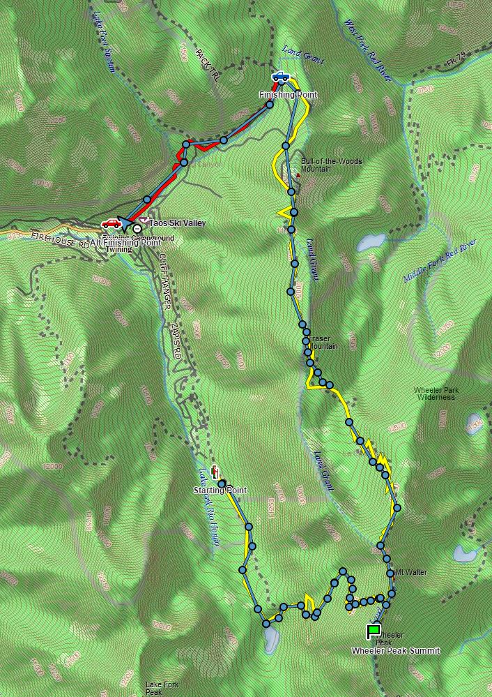
Red and yellow lines were the planned route, with the the starting point marked by the hiker and the finishing point marked by the red car. The blue line represents the actual route taken. The blue truck was a pickup point higher up the mountain that didn’t work out.
Starting Out
Susan drove up the mountain as far as the trees would allow. She dropped me off around 10,400′ elevation and I was surprised to find snow on the ground that low. The snow was icy and I was glad to be wearing microspikes. The trail wound gently (that’s relative) upwards through the forest, and was easy going all the way to Williams Lake at an elevation 11,072 ft.
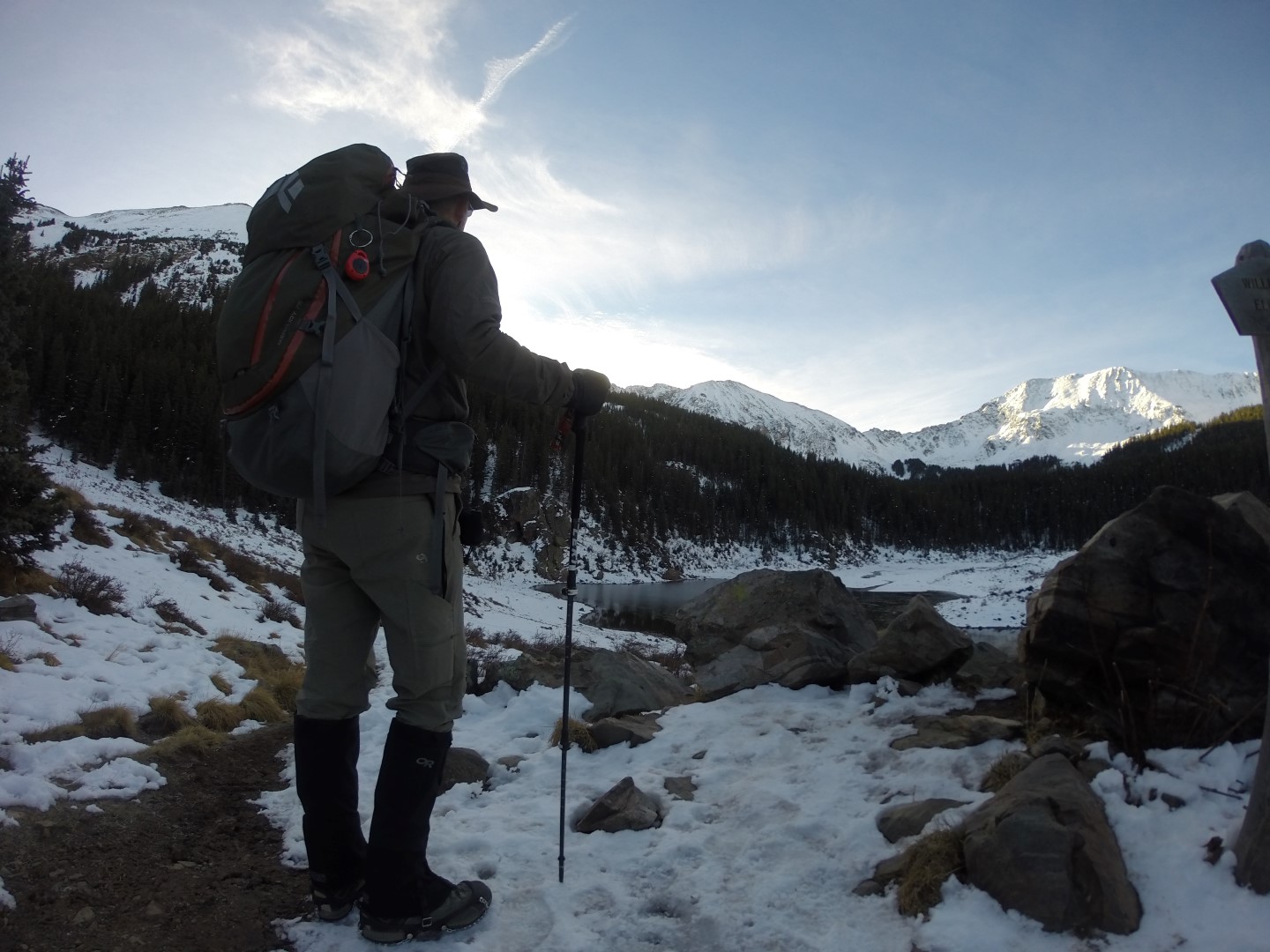
Williams Lake after which this route is named, marked the end of pleasant hiking.
After Williams Lake, the trail was completely obscured by deep snow and difficult to find. I was postholing up to my knees and was glad I had marked the route ahead of time and relied on my satellite beacon to find my way. I did find the trail again and the snow on the trail was reasonably consolidated and I only sank into the snow a little.
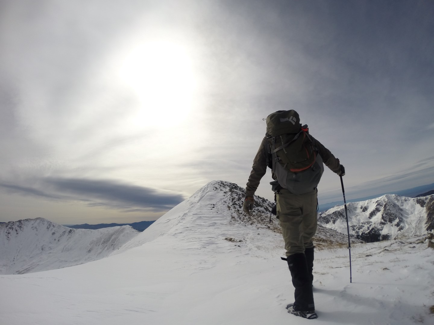
As the mountain became steeper, the trail folded into switchbacks to make the climb easier. I was feeling froggy, so I decided to go straight up the mountain. That turned out to be a very bad idea as the snow off the trail was very deep and postholing my way up the steep slopes cost me a lot of time and energy.
Snowshoes would have been nice here, but alas, I had none thanks to ranger X.
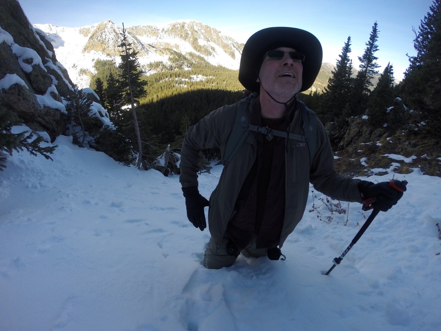
Yep, I’m climbing in snow up to my crotch. That’s why they call it “crotch deep snow”.
I finally made it back to the trail and resolved not to take anymore shortcuts. however the trail was deteriorating as I ascended and postholing in deep snow would become more common that not.
Danger at 12,800′
Yes, that is a pun, but it’s really a pretty good one don’t you think? Anyway, around 12,800′ the slopes were even steeper with soft snow that the trail wound up in a series of switchbacks. There was a very unfriendly looking rock field below, and despite my middle name, I was on high alert. The unconsolidated snow kept letting go as I worked my way across the slope and I was really missing my ice axe at this point and ended up breaking a trekking pole when I used it to arrest a fall.
Once past this area, the snow continued to degrade, but the route was less exposed. The wind intensified as I climbed higher and I decided to take a lunch break just below the exposed summit ridge. It was well below freezing and dropping, so I layered up and enjoyed the fantastic peanut butter and jelly sandwich Susan prepared for me on homemade bread cooked the night before.
I noticed a couple of large black birds sailing the wind overhead. They didn’t flap, but just stuck their wings out and hung in the air 10 feet above me.
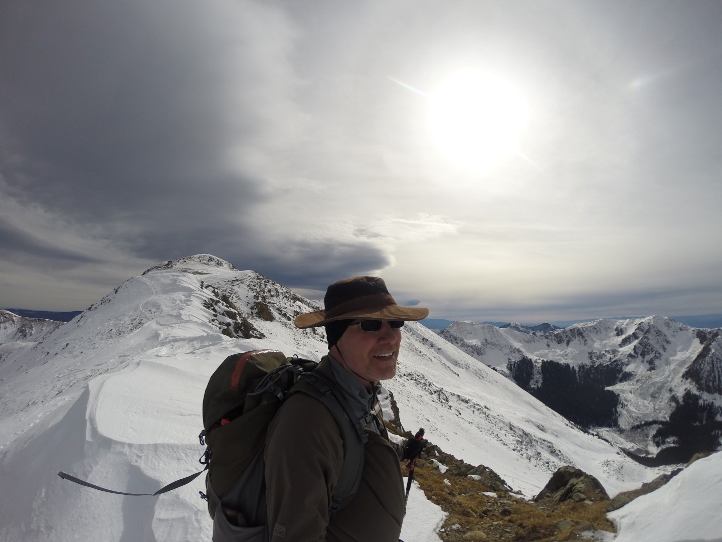
Summit Ridge
Once I crested the upper ridge the trail conditions were much improved as the wind had blown away the loose snow and was attempting to do the same to me. I could see storm clouds approaching as I approached the summit, but there was no turning back, storm or not.
Danger striding powerfully towards the summit
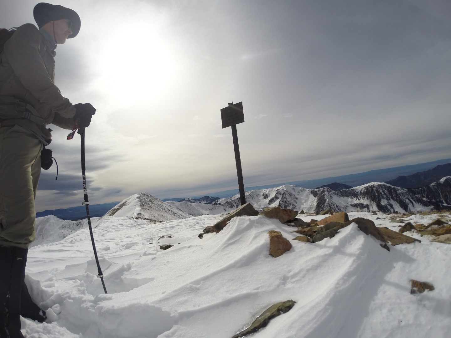
Summit Time
As I reached the summit the temperature dropped further, and the wind intensified. It was not a pleasant place to be, so I didn’t plan on staying long.
I carry a couple of GoPros, but typically take the important shots on my Olympus TG3 which has remote viewfinder and trigger functions via an iPod. However when I attempted to make the WiFi connection between them, it failed, and I was not about to do IT support at the top of this mountain, so I took my initial summit shot with one of the GoPro cameras.
Danger stands on the summit of Wheeler Peak, NM in 60+ MPH winds.
I then huddled behind the summit monument, making a quick blog post to memorialize this accomplishment.
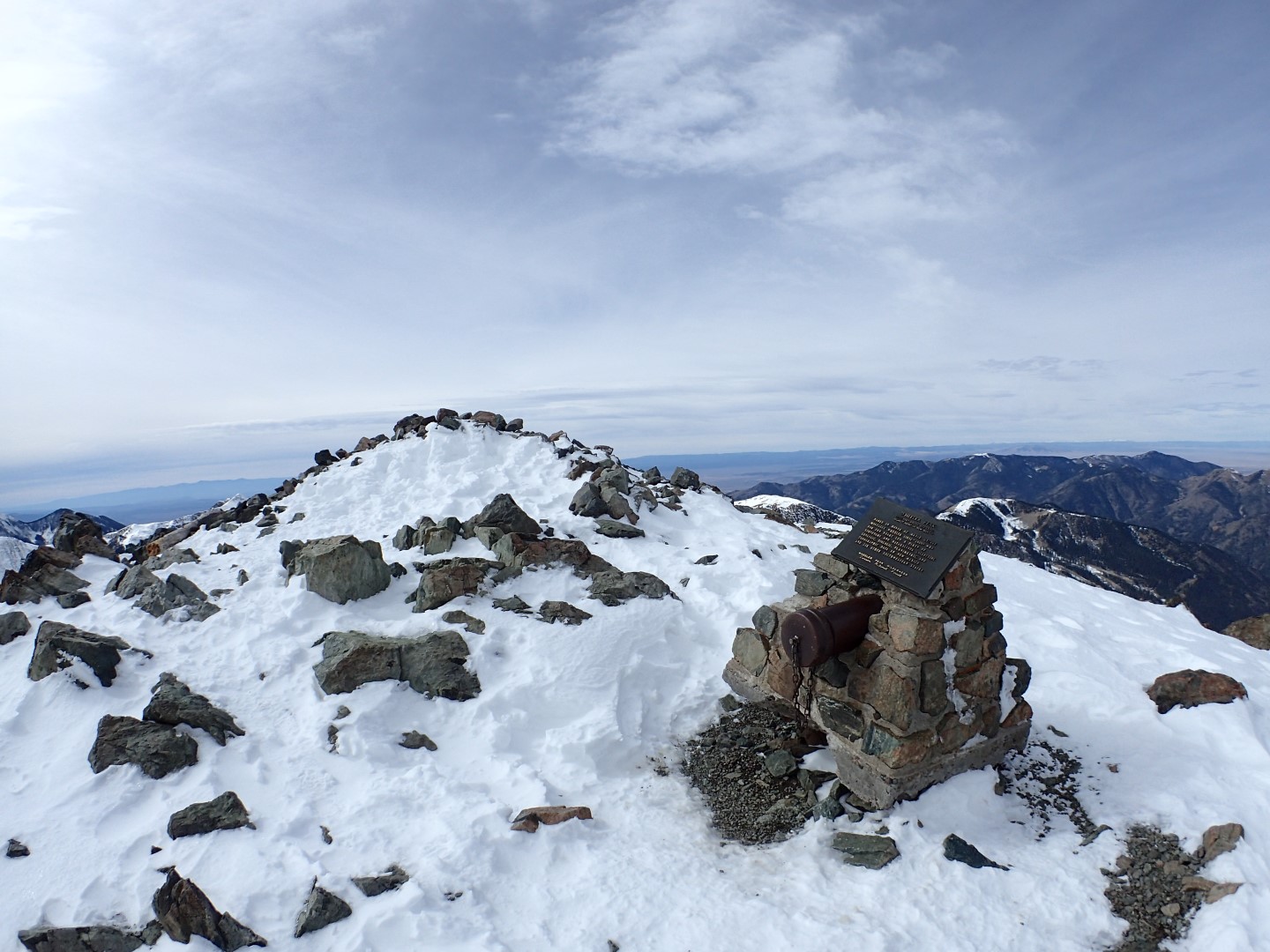
The sturdy summit monument has a register tube with a screw off lid.
The summit monument resembled a cannon with its barrel like tube. It featured a screw off cap, and of course I screwed it off. It had the expected summit register logs, which I rarely bother with. Additionally it had lots of other things, like band aids, batteries, cheap headphones, lighters, some string and a condom for those random mountaintop encounters that are so common. There was even a single glove for those of you who like to go Michael Jackson style.
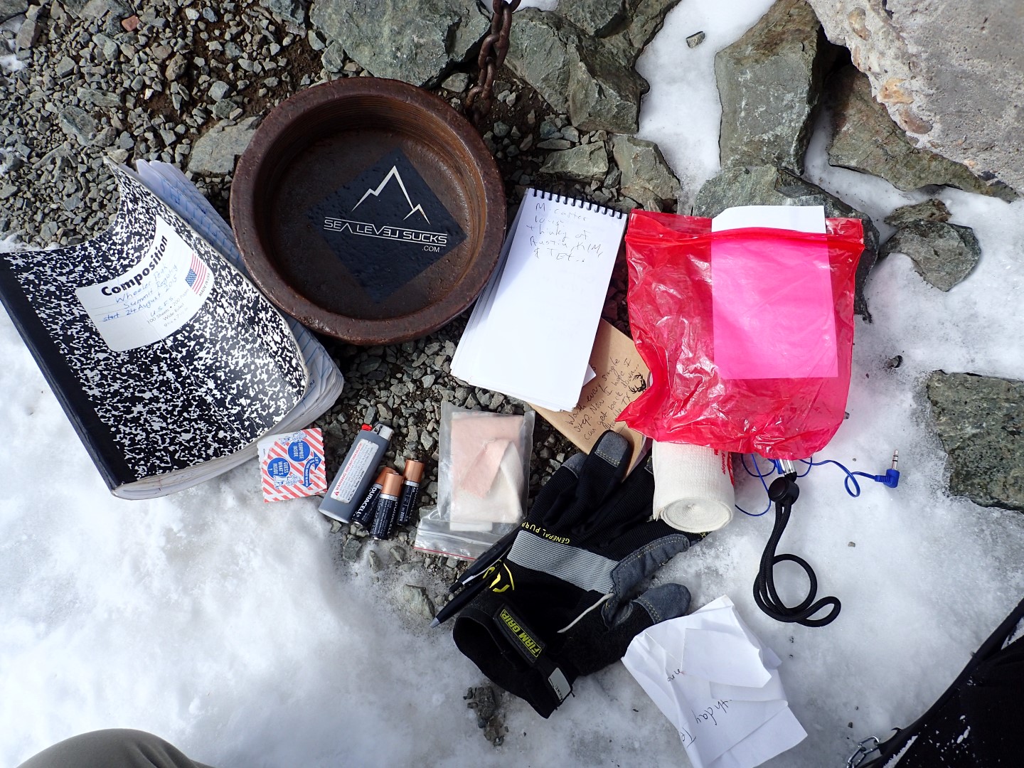
The summit register tube was mostly full of junk.
There was even a cracker jack prize, but you’ll never know what was inside, because I didn’t take that picture.
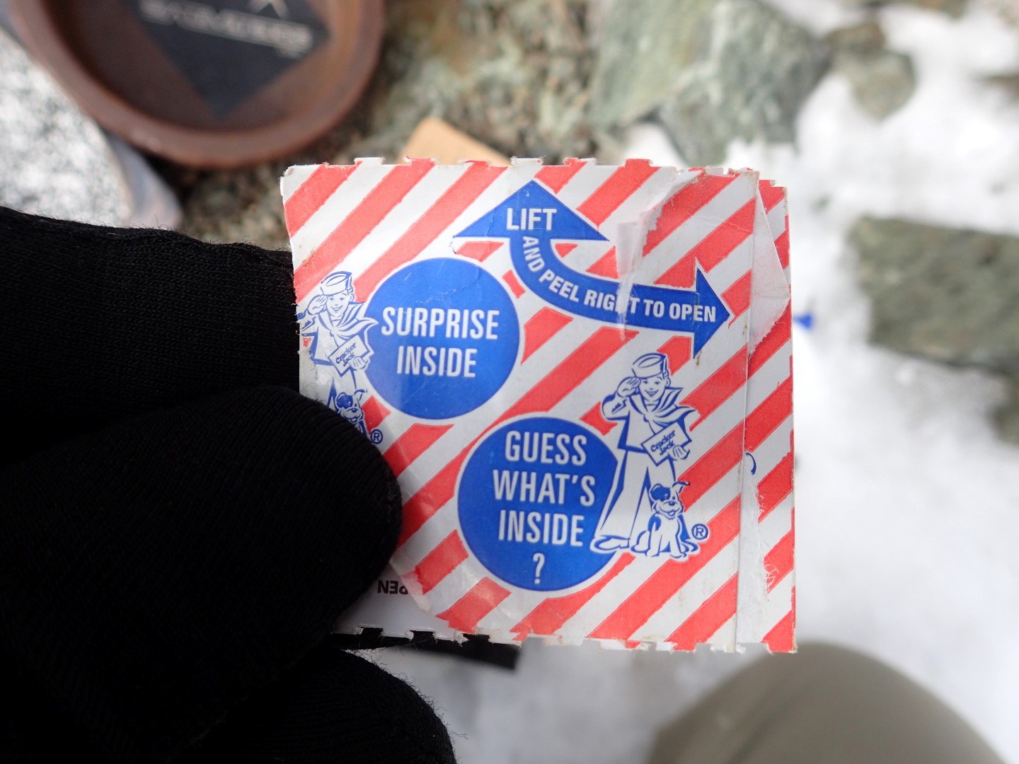
Guess whats inside?
A Blustery Day
The wind was intense at the summit, and being the curious type, I left the relative shelter of the summit monument long enough to get a wind speed reading which came back at 63MPH.
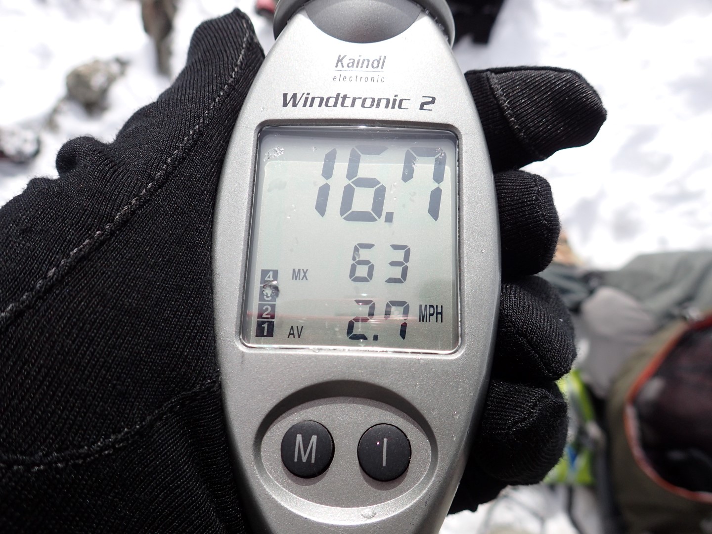
It was pretty windy at the summit. Ignore the average, I was hiding behind a rock and popped out a few seconds to get this reading.
While I stuffing the trash back in its hole, a couple of climbers, Allan and Roy made the summit. I talked with them a few minutes, and learned that they had just done the Arizona state high point, and were headed to Texas next. We exchanged contact information and they went back down the Williams Lake Route and I went north along the Twinning-Blue Lake trail.
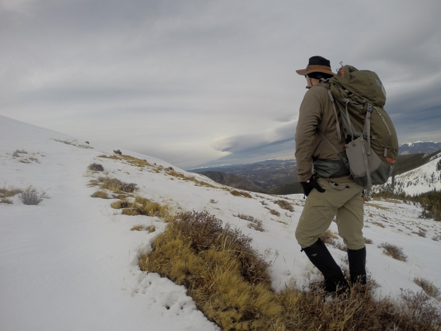
Descending
Most people go up and down the same route, but I wanted to experience both sides of the mountain, so I came up the steeper more challenging Williams Lake route, and headed down the more gradual more scenic Twinning-Blue Lake trail route. The first part of the descent followed the mountain ridge. If you are not bothered by the exposure, ridge routes are often the most enjoyable because of the unobstructed views and this was indeed a beautiful route.
Hiking north along the summit ridge on the descent, the scenery was dramatic.
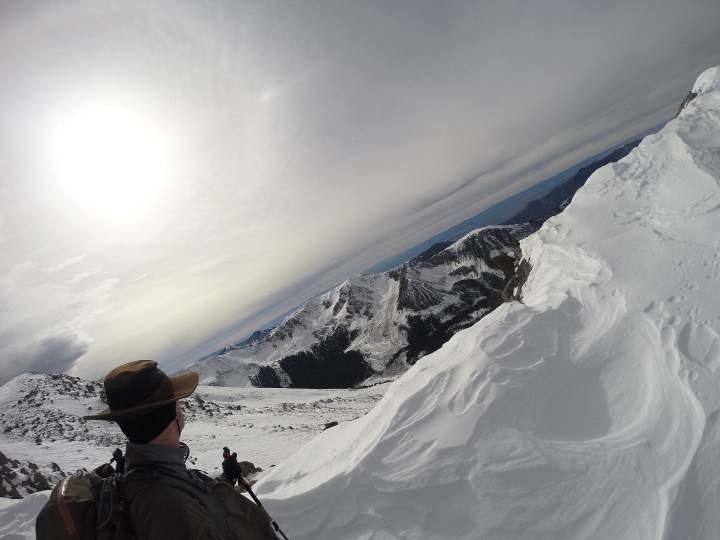
The views from the ridge were by far, the best of the day.
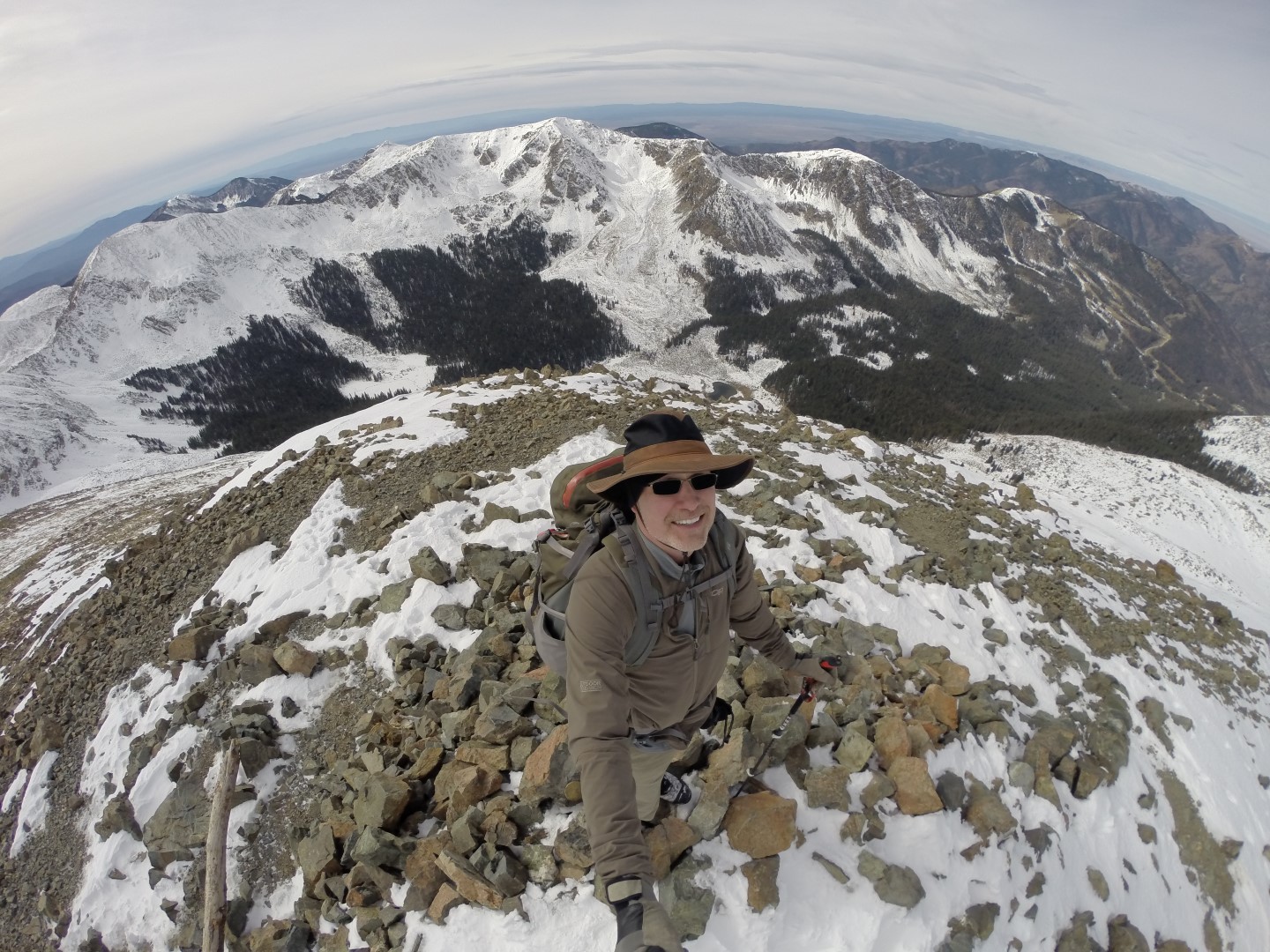
Shortly after leaving the highest point in New Mexico, I found myself atop Mount Walter second highest mountain in New Mexico.
I’m on the highest mountain in New Mexico, now I’m on the second highest mountain. Now I’m on a boat, now a horse… If your man worked really hard, he could smell like me.
The unfortunate fact of this route, was that nobody had been this way in a long time so there was no trail at all. I was once again, breaking trail. It was grueling work, and there was no point following the established trail, and steep slopes don’t bother me, so I ignored the switchbacks and went straight down the mountain post holing all the way and dreaming about snowshoes.
There were some breaks in the deep snow, as well as a lot of ascending and descending I crossed over peaks and valleys. There were some threatening storm clouds, but they were benign in the end.
A dramatic cloud formation seen during the descent
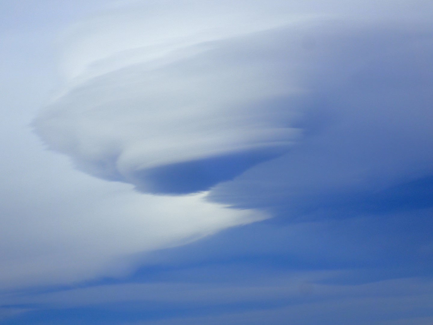
That same cloud formation shot with the Olympus TG-3 through a telephoto lens
I ran out of daylight, but I don’t mind that as seeing the sunset in the mountains is generally quite a spectacle, and this was no exception.
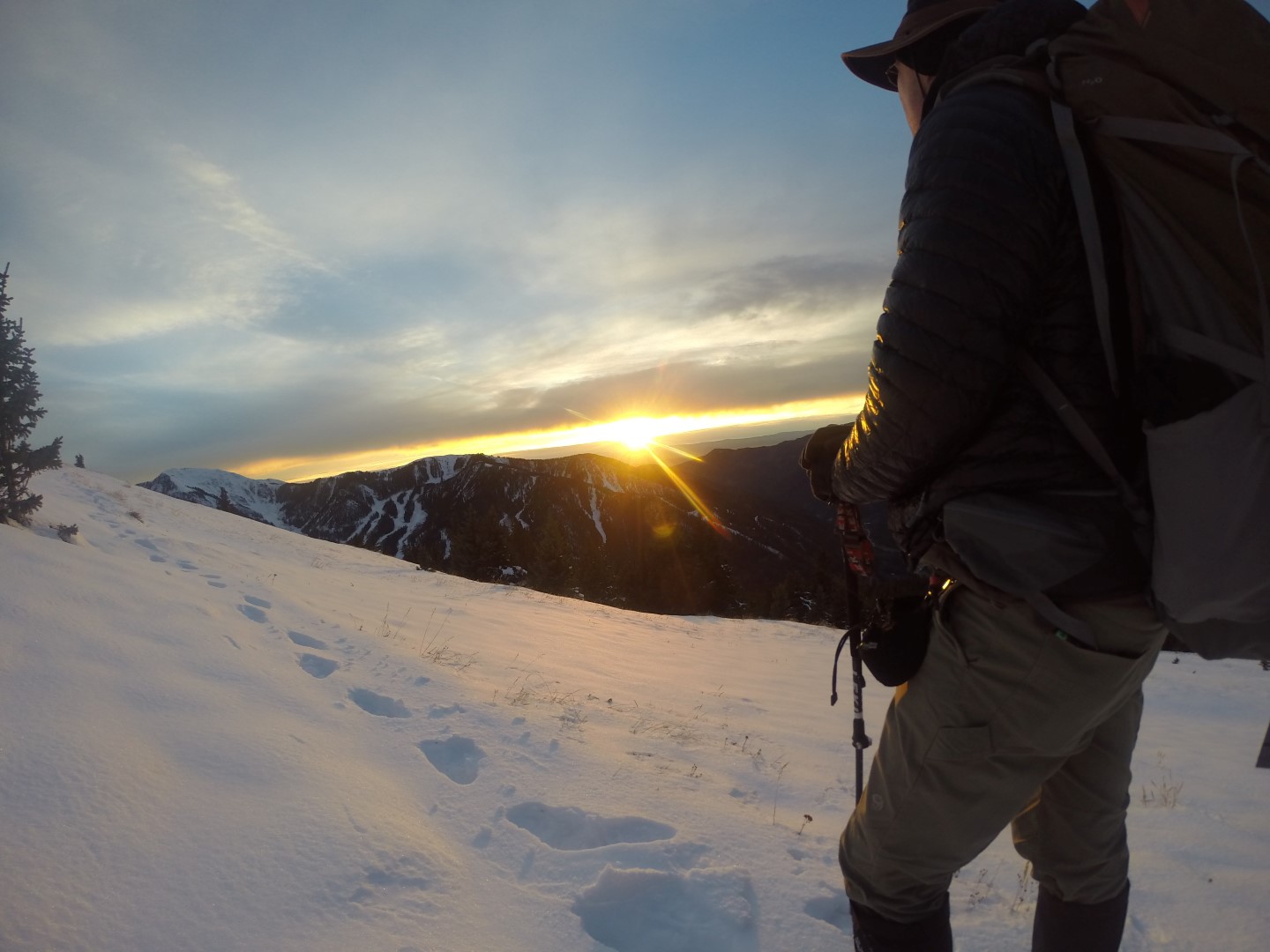
Danger looks back on a fabulous mountain sunset
So I completed the last part of the descent in the dark, and relied on my headlamp to light my path. The mountains are strange in the dark, and you get the sense that you are on an alien planet.
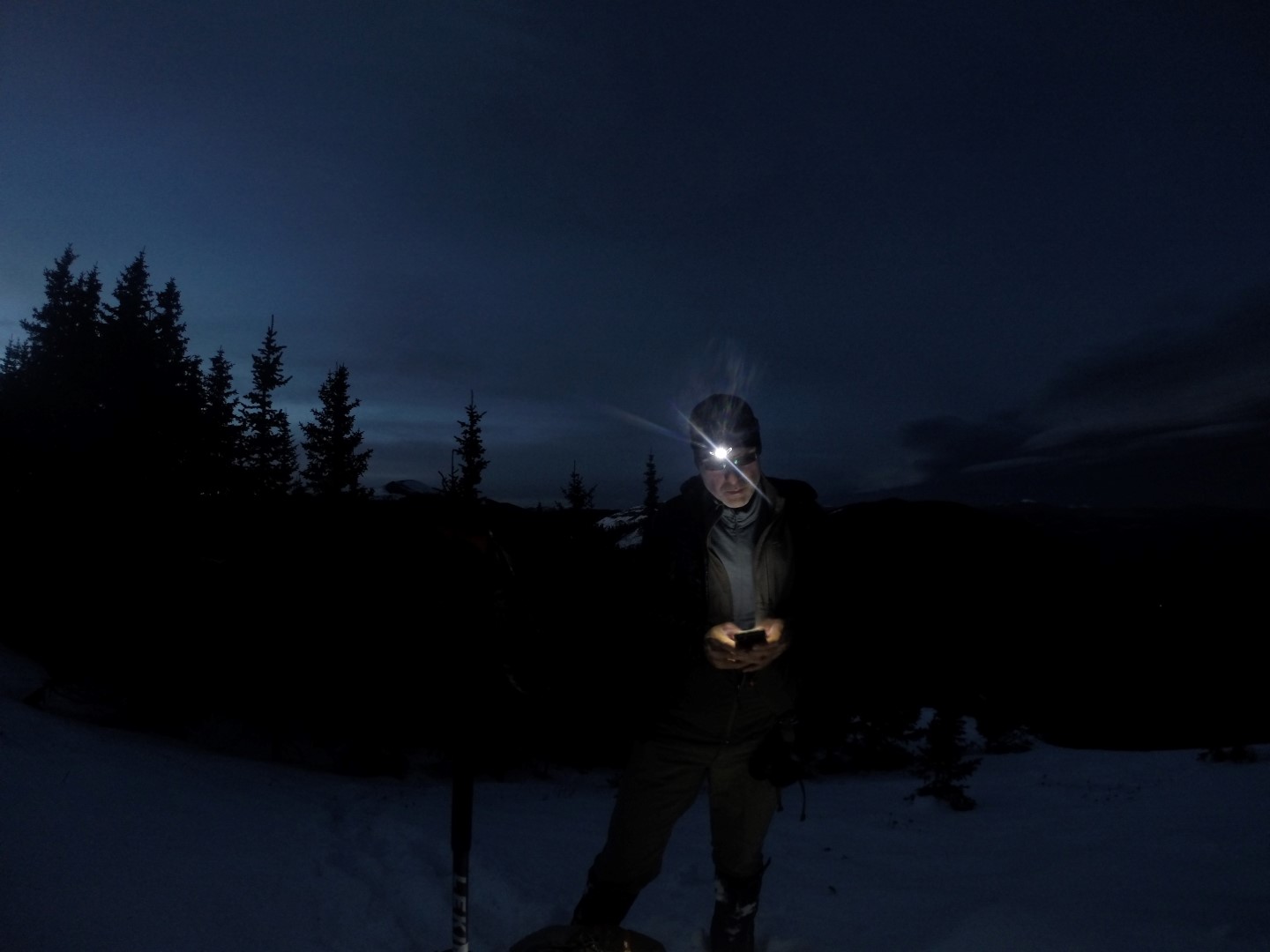
Blogging in the dark, about it being dark.
The long day and all of the trail breaking was taking its toll, but my fortunes finally changed and I sent this post.
Either Jesus granted me the ability to walk on snow, or its re-freezing. NO POST HOLING for last hour. I was about ready to build a snow cave back there.
So the last couple of hours were easy going despite Susan not being able to pick me up higher on the mountain as I had planned. I found here anxiously waiting for me at the bottom.
While we drove back to the coach, I laughed when Susan shared her side of the story with me, so I encouraged her to write her first Danger blog post.
from Susan’s vantage point
As I strode into the Stray Dog Cantina, the proprietor yelled “Keep it clean, boys; there’s a lady in the house.” The only others in the cantina were nine burly men lined up at the bar, trading salty tails of mountain bravado. I took a table as far in the back as the tiny bar allowed. The proprietor walked up to me saying, “Sorry for the crowd, but it’s all I’ve got.” I ordered their only red and felt so conspicuous, I was compelled to explain that I was meeting my husband soon, as he was descending from the summit of Wheeler Peak. To which he said, “I hope he’s alright, because those three guys getting sloshed at the end of the bar are the mountain rescue team.” This was not particularly reassuring, and overhearing their slurred conversation that went something like this didn’t help:
“A local gets killed up here and nobody gives a @*#!……but let an outsider die and we never here the @*#! end of it…….and if a kid bites it, all hell breaks loose…those @#$@*%# reporters! They really rake us over the @#$@*%# coals.”
Maybe I should have waited in the Jeep, but the freezing weather drove me inside. Hoping Robert was close, I nervously refreshed my “where in the world is danger?” iPad app.
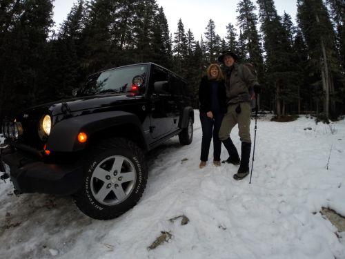
Susan & Robert at the difficult to reach Wheeler Peak Trailhead
This was my second trip up the steep winding road to the mountain. In the dark of morning, I drove Robert towards the trail. Finding several roads closed, we jogged back and forth to gain access to the trailhead. Finally, we made it to a steep, snow covered trail just wide enough for the Jeep. I put on my brave face, locked in the 4 wheel drive and forced the Jeep up the icy terrain until the trail narrowed to a horse’s width. I said a prayer, kissed my husband good bye, and promised I’d be on the other side of the mountain by nightfall, awaiting his return.